![]()

![]()
![]()
Apoios
![]()

Portuguese coast is directly exposed to Atlantic Ocean waves. Severe storms frequently impact on it, causing hazards for the population and coastal infrastructures and having serious economic and environmental consequences.
Then, there is a need to provide the national authorities with tools for an integrated management of these hazards and risks.
The projects objective is the development, implementation and validation of a set of tools/methodologies on a WebGIS system, HIDRALERTA, to help authorities to monitor, prevent and/or manage wave driven overtopping and flooding emergency events in coastal and harbour areas and to manage those areas on a long-term basis. This system will be assembled as a tool for port and coastal management that will finally support decision makers (Civil Protection, Port Authority) providing added value and potential benefits for such areas.
The major feature of this system is the focus on wave driven overtopping and flooding. Although there are already several early warning systems geared towards the coastal zone, they deal mainly with flooding due to high tides and storm surges. There is a lack of these systems especially for port or coastal zones where wave overtopping volumes occur.
The new system, based upon previous team work HIDRALERTA (aurora.lnec.pt), will include the tools/methodologies to become more efficient, reliable and robust, namely the use of satellite and video images, numerical and physical modelling, quantitative and probabilistic risk assessment techniques and emergency planning tool to enhance the reliability and efficiency of the system.
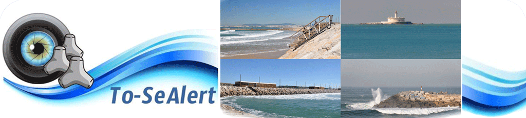
The test cases are the Costa da Caparica beach and the Ericeira port, sites where every year wave overtopping and flooding events occur with significant consequences for the infrastructures, goods and people.
Tasks:
T1 - use of satellite images for the historical characterization of wave fields and flooded areas;
T2 - the integration of video monitoring systems for in situ monitoring and characterization of waves, overtopping and flooded areas, and consequent system validation and calibration;
T3 - the use of physical model to validate the numerical models system;
T4 - integration of state of the art numerical models to simulate wave overtopping and flooding;
T5 - use of risk assessment methodologies to quantify risks, using multicriteria and probabilistic methods; establishment of emergency plans for hazards;
T6 - assemble an adequate and innovative WebGIS platform to build a decision support tool;
T7 - HIDRALERTA prototypes for Ericeira and Costa da Caparica sites.
The innovation of HIDRALERTA stems from the coupling and validation of the above methodologies, to add the most advanced numerical models for wave overtopping and flooding simulation, new methods to validate/calibrate wave overtopping simulation (remote sensing and video), new useful components (emergency planning) and an improved methodological approach for risk assessment.